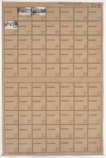
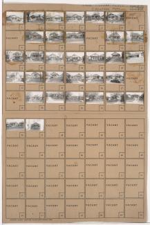
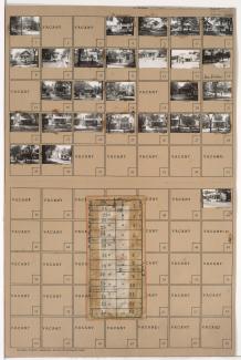
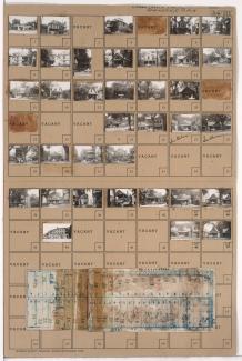
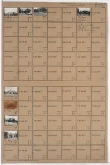
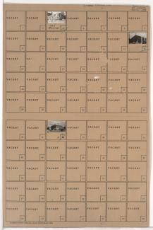
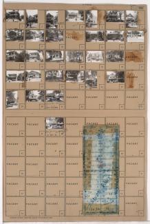
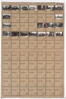
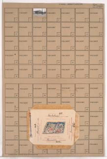
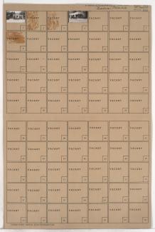
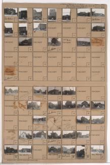
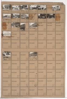
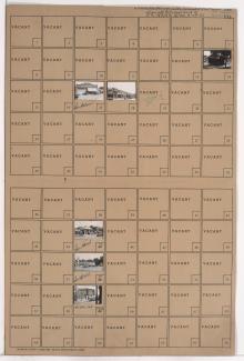
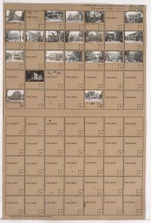
Tax Assessment Block Folder, Kansas City, MO, District 4, Block 111
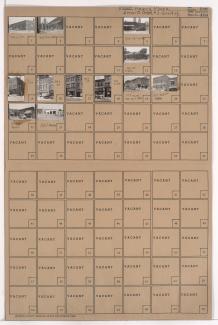
Folder contains photographs of businesses and other buildings in the Peery Place addition, from 11th Street south to 12th Street, and Holmes Street east to Charlotte Street.
Folder contains photographs of buildings in the West Blue Valley neighborhood, from 14th Street south to 15th Street (later Truman Road), and Lawndale Avenue east to Topping Avenue.
Folder contains photographs of residences and businesses in the South Blue Valley neighborhood, from 23rd Street south to 24th Street, and Hardesty Avenue east to Drury Avenue.
Folder contains photographs of residences, businesses, and other buildings in the Oak Park Northwest neighborhood, from 38th Street south to 39th Street, and South Benton Avenue east to Agnes Avenue. Agnes Market, at 3800 Agnes, is among the buildings pictured. Folder also includes a plat map of the block.
Folder contains photographs of residences, businesses, and apartment buildings in the North Hyde Park neighborhood, from Linwood Boulevard south to 33rd Street, and Gillham Road east to Holmes Street. Gillham Pharmacy, at 3269 Gillham Road, and Ed's Florists (also known as Ed's Dainty Corsages), at Linwood and Gillham, are among the buildings pictured. Folder also includes a plat map of the block.
Folder contains photographs of businesses in the Brookside neighborhood, from 62nd Terrace south to 63rd Street, and Brookside Boulevard east to Main Street. The John S. Watkins Drugstore, at 6249-6251 Brookside Boulevard, is among the buildings pictured.
Folder contains photographs of businesses and other buildings in the Ivanhoe neighborhood, from Brush Creek south to Swope Parkway, and Paseo Boulevard east to Prospect Avenue, including sections of Park Avenue, Olive Street, and Wabash Avenue. Parkway Tire Shop, at 4736 Prospect, and St. Mary's Catholic Church, at 2322 Swope Parkway, are among the buildings pictured. Folder also includes a plat map of the block, which can be viewed below.
Folder contains photographs of residences, businesses, and apartment buildings in the Volker neighborhood, from 42nd Street south to 43rd Street/Westport Road, and Mercier Street east to Holly Street. Bradley's Filling Station, at 1200 Westport Road, is among the buildings pictured. Folder also includes a plat map of the block.
Folder contains photographs of residences and businesses in the Citadel neighborhood, from 61st Street south to 63rd Street, and Paseo Boulevard east to Blue Hills Road.
Folder contains a photograph of a building in an area of Northeast Kansas City, from Front Street south to Guinotte Avenue, and Troost Avenue east to Forest Avenue. Folder also contains plat map of the block.
Folder contains photographs of businesses in the Quality Hill neighborhood, from 13th Street south to 14th Street Trafficway, and Washington Street east to Broadway Boulevard.
Folder contains photographs of businesses and residences in the West Bottoms district, from 9th Street south to St. Louis Avenue, and Genessee Street east to Wyoming Street, including a section of Nero Street. Imperial Casket Company, at 920-924 Wyoming, is among the buildings pictured.
Folder contains photographs of businesses and other buildings in the West Bottoms district, from 16th Street south to 17th Street, and Genessee Street east to Wyoming Street. The Charles P. Shipley Building, at 1627 Genessee, the Cowboy Inn, at 1616 Wyoming, and the Wyoming Club, at 1622 Wyoming, are among the buildings pictured.
Folder contains photographs of businesses and residences in the Crown Center district, from Pershing Road south to 25th Street, and McGee Street Trafficway east to Oak Street. Wright's Smoke Company, at 2433 Oak, is among the buildings pictured.
Folder contains photographs of residences, businesses, and other buildings in the Parkview neighborhood, from Independence Avenue south to 7th Street, and Euclid Avenue east to Garfield Avenue. The Stonleigh Court Apartment House, at 2001-2007 Independence Avenue, is among the buildings pictured.