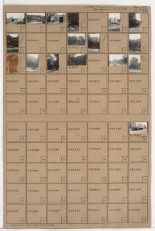
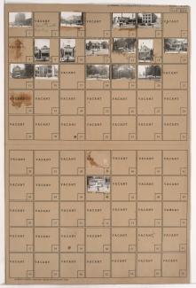
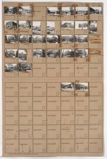
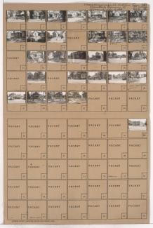
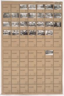
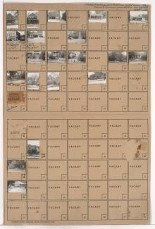
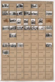
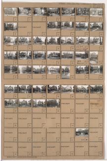
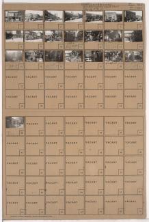
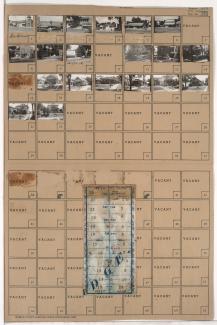
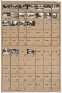
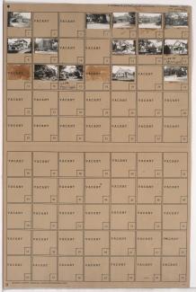
Tax Assessment Block Folder, Kansas City, MO, District 4, Block 149
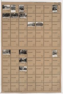
Folder contains photographs of residences, businesses, and other buildings in McGee's Addition, from 16th Street south to 17th Street, and Cherry Street east to Holmes Street.
Folder contains photographs of residences, businesses, and other buildings in Haefner's 1st Addition, from 15th Street (later Truman Road) south to 16th Street, and Holmes Street east to Charlotte Street. Imperial Music Company, at 1510 Charlotte, is among the buildings pictured.
Folder contains photographs of residences and other buildings in the Downtown East neighborhood, from 15th Street (later Truman Road) south to 16th Street, and Troost Avenue east to Forest Avenue. The Calvin Company building, at 15th and Troost, and Diamond T Truck and Parts Company, at 1109-1113 East 15th, are among the buildings pictured.
Folder contains photographs of residences and businesses in the Abington Park subdivision, from St. John Avenue south to Anderson Avenue, and Cypress Avenue east to Elmwood Avenue. Uncle Charlie's Fruit Market is among the buildings pictured.
Folder contains photographs of residences and businesses in the Key Coalition neighborhood, from 30th Street south to 31st Street, and Wabash Avenue east to Prospect Avenue. An A&P Supermarket, at 3018-3022 Prospect, and Robert Blond Food Market, at 3042 Prospect, and the Linwood Theater, at 3034-3036 Prospect, are among the buildings pictured.
Folder contains photographs of residences, businesses, and other buildings in the Lykins neighborhood, from Independence Avenue south to 6th Street, and Van Brunt Boulevard east to Brighton Avenue.
Folder contains photographs of residences and businesses in the Lykins neighborhood, from Independence Avenue south to 7th Street, and Cypress Avenue east to Elmwood Avenue.
Folder contains photographs of residences and businesses in the Lykins neighborhood, from 9th Street south to Cloon Avenue, and Jackson Avenue east to Spruce Avenue.
Folder contains photographs of residences and businesses in the East Community Team neighborhood, from 15th Street (later Truman Road) south to 16th Street, and Chelsea Avenue east to Poplar Avenue.
Folder contains photographs of residences and businesses in the East Community Team neighborhood, from 15th Street (later Truman Road) south to 16th Street, and Myrtle Avenue east to Jackson Avenue, including a section of Norton Avenue.
Folder contains photographs of residences and businesses in the West Blue Valley neighborhood, from 15th Street (later Truman Road) south to 16th Street, and Hardesty Avenue east to Drury Avenue.
Folder contains photographs of residences and businesses in the Sheffield neighborhood, from Independence Avenue south to 7th Street, and Newton Avenue east to Ewing Avenue.
Folder contains photographs of residences, businesses, and apartment buildings in the Santa Fe neighborhood, from 27th Street south to Lockridge Street, and Prospect Avenue east to Benton Boulevard. Folder also contains a plat map of the block, which can be viewed below.
Folder contains photographs of residences, businesses, and other buildings in the South Hyde Park neighborhood, from Brush Creek Boulevard south to 47th Street, and Harrison Street east to Troost Avenue. Park National Bank, at 4628 Troost, is among the buildings pictured. Miller Screen Company, at 4602-4604 Troost, Penny's Place, at 4606 Troost,
Folder contains photographs of residences and businesses in the Ivanhoe Southeast neighborhood, from 41st Street south to 42nd Street, and Wabash Avenue east to Prospect Avenue.
Folder contains photographs of residences and businesses in the Western 49-63 neighborhood, from 55th Street south to 56th Street, and Harrison Street east to Troost Avenue. A Kroger grocery store, at 5500 Troost, is among the buildings pictured. Folder also includes a plat map of the block.
Folder contains photographs of residences and businesses in the Western 49-63 neighborhood, from 59th Street south to 60th Street, and Harrison Street east to Troost Avenue. Bumper Ice House, at 5910 Troost, is among the buildings pictured.
Folder contains photographs of residences and businesses in the Western 49-63 neighborhood, from 60th Street south to 61st Street, and Harrison Street east to Troost Avenue. Quigley Music Studios, at 6026 Troost, and Parker's Market, at 6060 Troost, are among the buildings pictured.
Folder contains photographs of residences, businesses, and other buildings in the Western 49-63 neighborhood, from 62nd Street south to 63rd Street, and Harrison Street east to Troost Avenue. South Side Transfer and Storage, at 6244 Troost, is among the buildings pictured.
Folder contains photographs of residences and other buildings in the Volker neighborhood, from 39th Street south to 40th Street, and Genessee Street east to Wyoming Street. Roanoke Baptist Church, at 1600 West 40th, is among the buildings pictured. Folder also includes a plat map of the block.